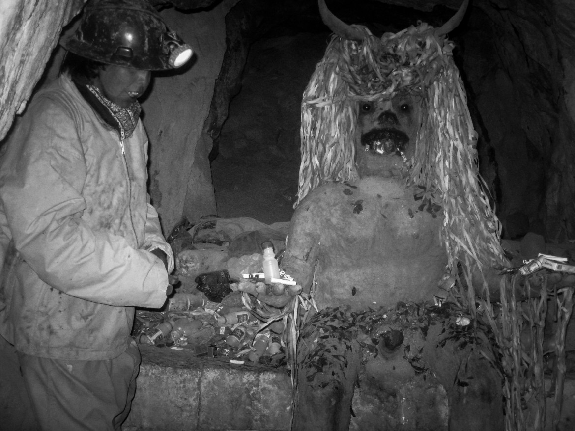
El Tio, mines Potosi, Bolivia
El Tío (The Uncle), is believed in Cerro Rico, Potosí, Bolivia as the Lord of the underworld. There are many statues of this devil-like spirit in the mines of Cerro Rico. El Tío rules over the mines, simultaneously offering protection and destruction. Some figures are really in the shape of a goat.
Miners bring offerings such as cigarettes, coca leaves, and alcohol for the statues and believe that if El Tío is not fed, he will take matters into his own hands. Villagers of Potosi ritually slaughter a llama and smear its blood on the entrance to the mines.
The miners of Cerro Rico are Catholics and they believe in both Jesus and El Tío. El Tío is similar to some voudou-Folk Catholicism cultures mythology, such as the spirits of protection, the loa, in Legba in Haiti and some cultures in New Orleans.
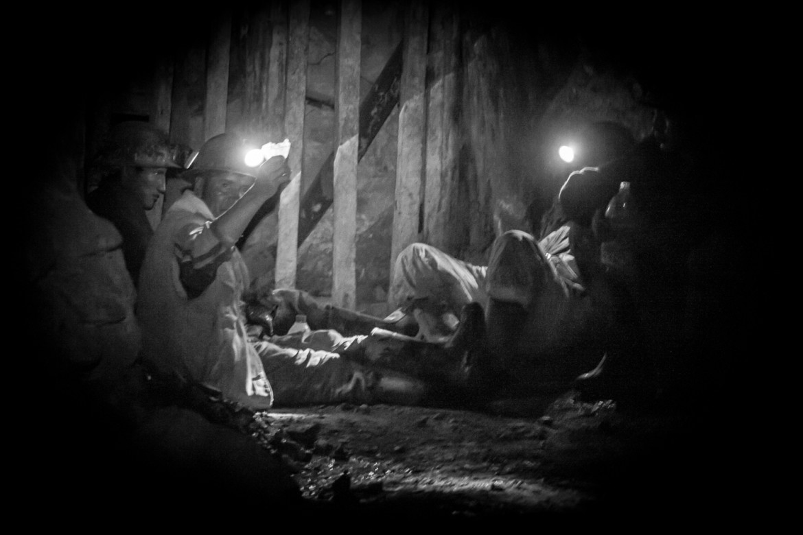
‘The mountain that eats men alive’, Potosi Mines, Bolivia
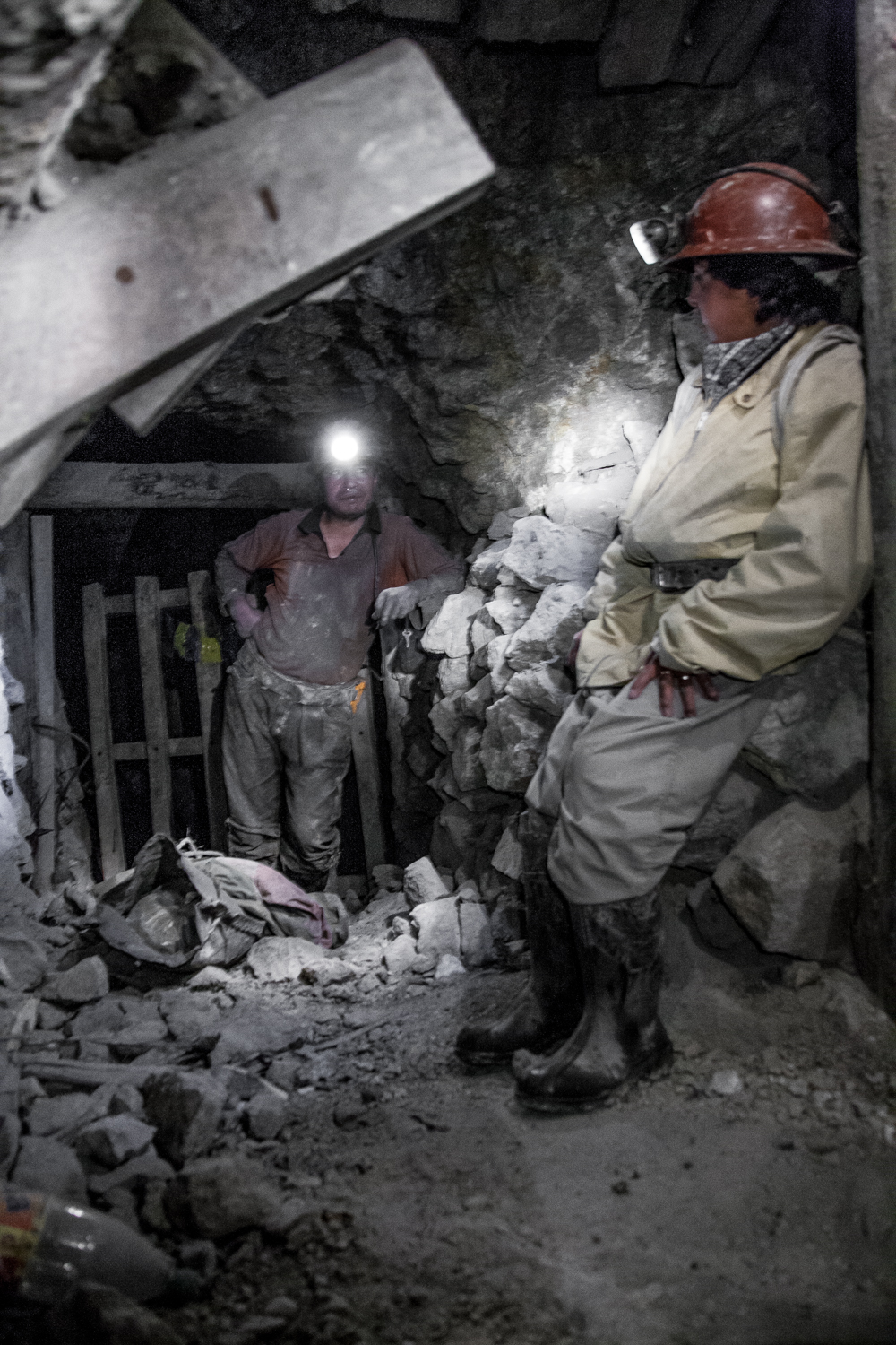
The work is precarious and dangerous. Many miners, including children as young as 11, brave toxic gases and the risk of mine collapses or electrocution with tools that have changed little since colonial times.
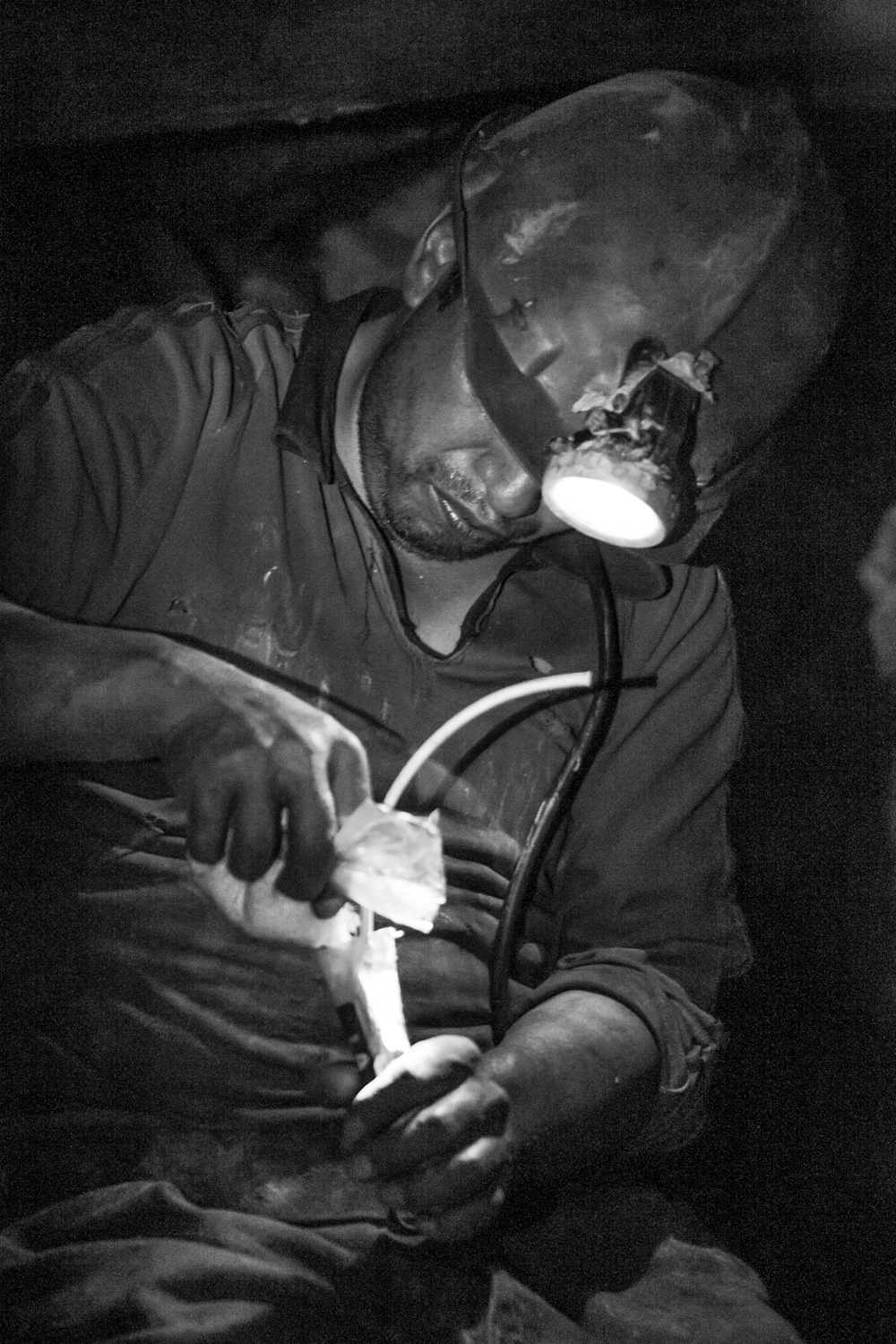
preparing explosives, Potosi mines, Bolivia
But last week, Unesco added Cerro Rico and Potosí to its list of endangered sites, owing to "uncontrolled mining operations" that risk "degrading the site".
But more than mining accidents, the biggest killer is silicosis, an incurable lung disease caused by inhaling large amounts of silica dust. Workers call it mal de la mina and, as few use protective masks, it is the biggest occupational hazard.
‘The mountain that eats men alive’, Potosi Mines, Bolivia
About 15,000 cooperative workers mine for silver, tin, lead and zinc in the mountain, which is pocked with hundreds of pitheads and criss-crossed with up to 20,000 tunnels. But the vast majority do not receive health insurance or pension benefits, and the cooperative sector routinely flouts basic safety laws.
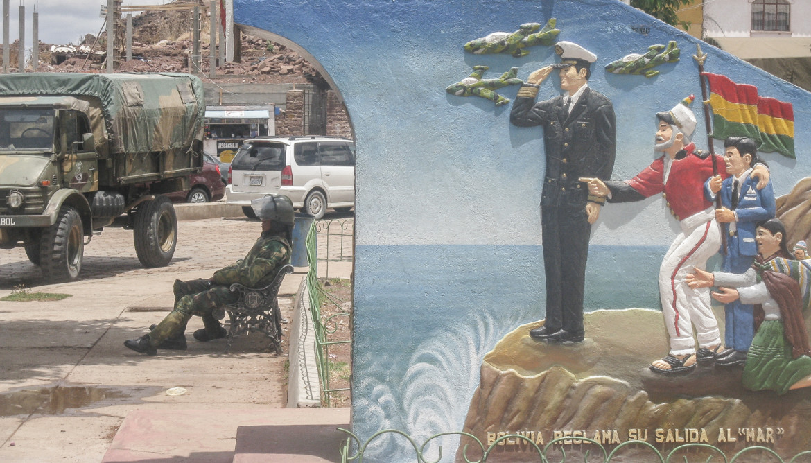
‘Bolivia claims its landlocked’, Chile-Bolivia borderline
The Atacama border dispute was a dispute between Chile and Bolivia in the 19th century that ended in the transfer to Chile of all of the Bolivian Coast and the southern tip of Bolivia's ally Peru through the Treaty of Ancón with Peru and the Treaty of Peace and Friendship of 1904 between Chile and Bolivia after the War of the Pacific (1879–1883). Some consider the dispute is still ongoing as Bolivia still claims a sovereign access to the Pacific Ocean. The conflict takes its name from the Atacama Desert on which lies the disputed territory. From the Chilean annexation of the Bolivian coast in 1879 the Puna de Atacama dispute arose due to Bolivian transfers of land to both Argentina and Chile, this spin-off dispute was settled in 1899.
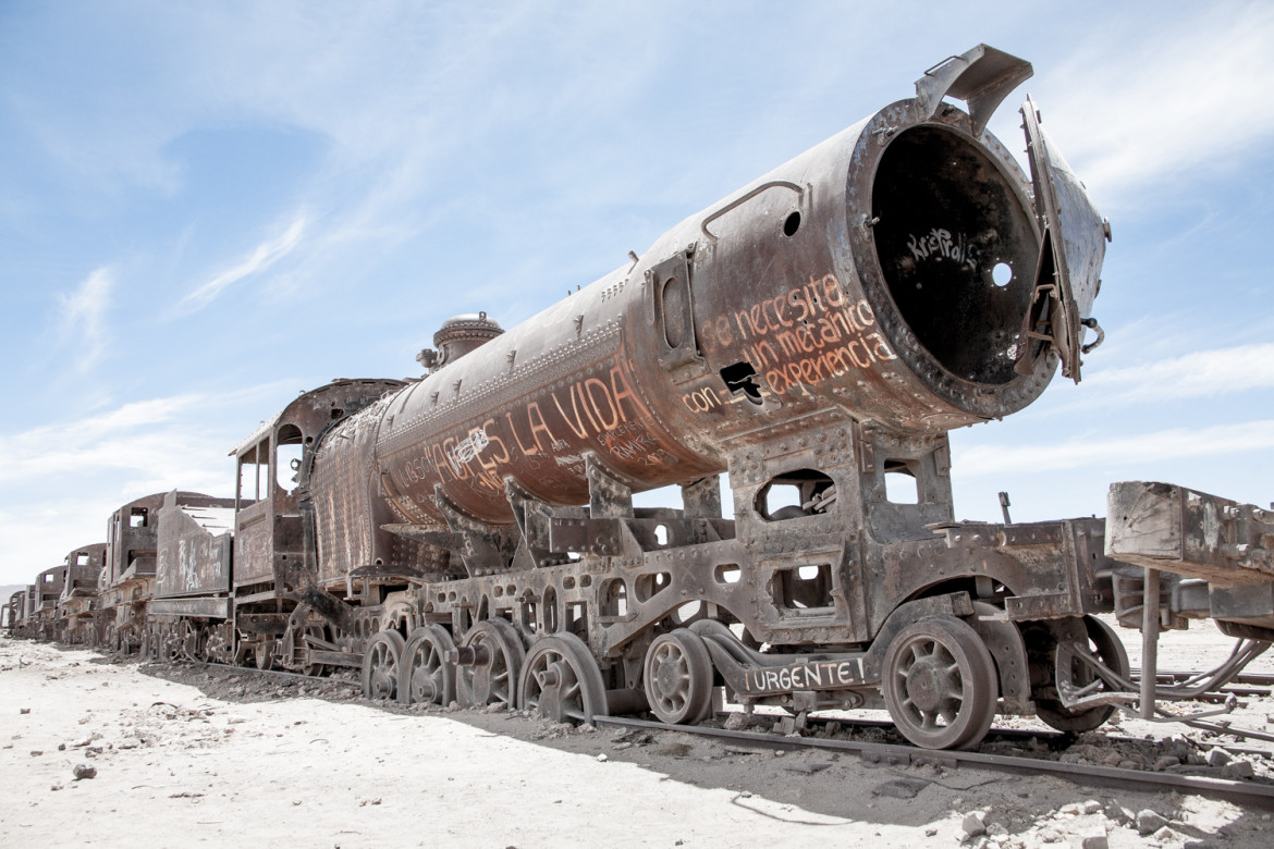
Train Cemetery in the desert, Bolivia
It is located 3 km outside Uyuni and is connected to it by the old train tracks. The town served in the past as a distribution hub for the trains carrying minerals on their way to the Pacific Ocean ports. The train lines were built by British engineers who arrived near the end of the 19th century and formed a sizable community in Uyuni. The engineers were invited by British-sponsored Antofagasta and Bolivia Railway Companies, which is now Ferrocarril de Antofagasta a Bolivia. The rail construction started in 1888 and ended in 1892. It was encouraged by the then Bolivian President Aniceto Arce, who believed Bolivia would flourish with a good transport system, but it was also constantly sabotaged by the local indigenous people who saw it as an intrusion into their lives. The trains were mostly used by the mining companies. In the 1940s, the mining industry collapsed, partly due to the mineral depletion. Many trains were abandoned thereby producing the train cemetery.
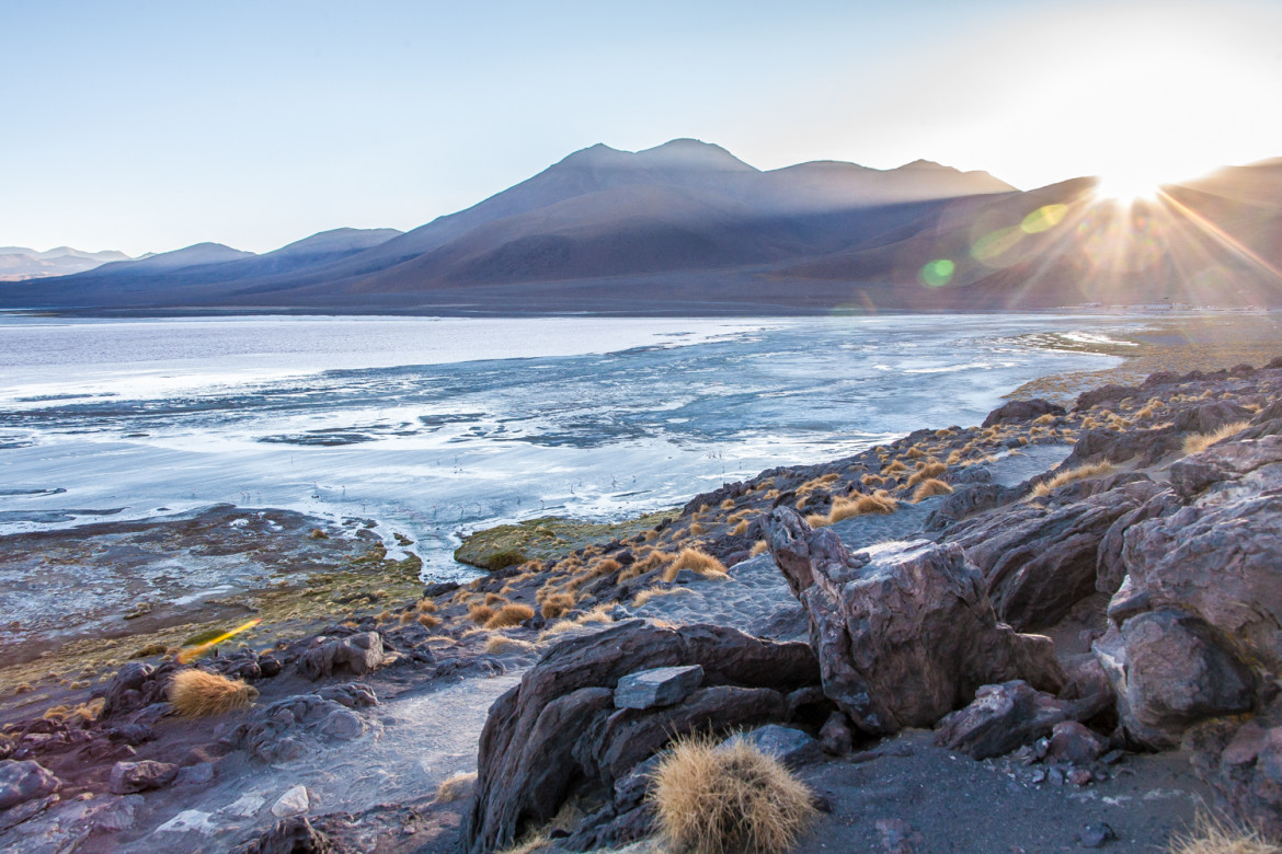
Laguna Colorada, Bolivia
Laguna Colorada (Red Lagoon) is a shallow salt lake in the southwest of the altiplano of Bolivia, within Eduardo Avaroa Andean Fauna National Reserve and close to the border with Chile.
The lake contains borax islands, whose white color contrasts with the reddish color of its waters, which is caused by red sediments and pigmentation of some algae.
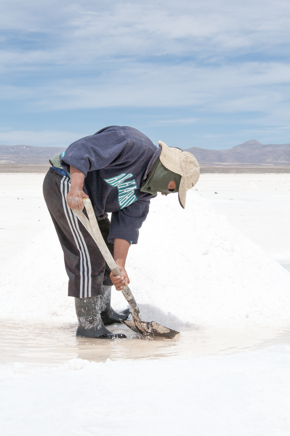
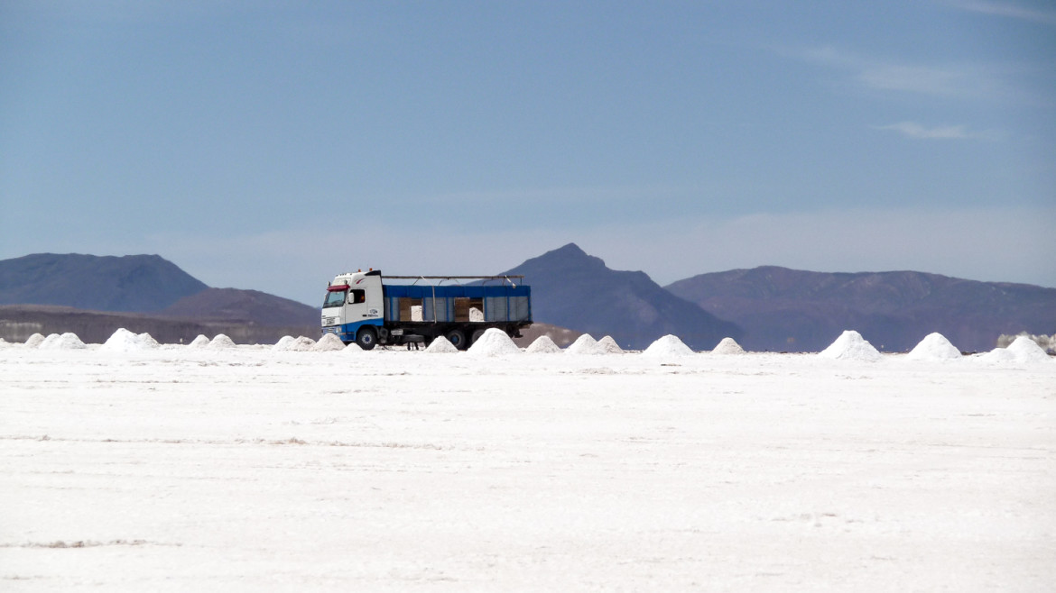
Salar De Uyuni, Chile
On the edge of the flats, local workers carve blocks of salt by hand for processing in nearby antiquated factories, covered head to toe in old rags to keep their bodies protected from the harsh conditions.
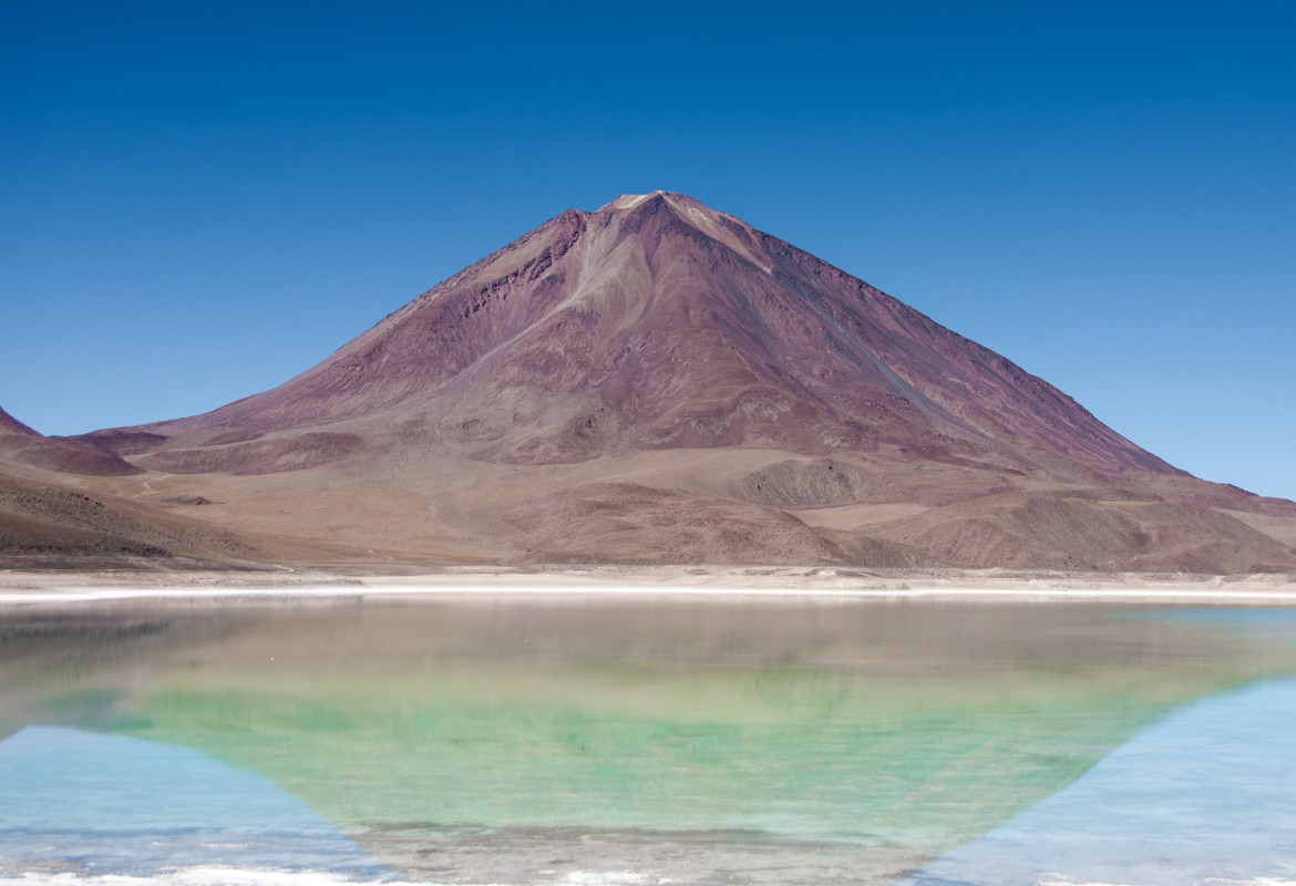
Laguna Verde, Chile
Laguna Verde (Spanish for "green lake") is a salt lake in and endorheic basin, in the southwestern Altiplano in Bolivia. It is located in the Sur Lípez Province of the Potosí Department. It is on the Chilean border, at the foot of the volcano Licancabur.
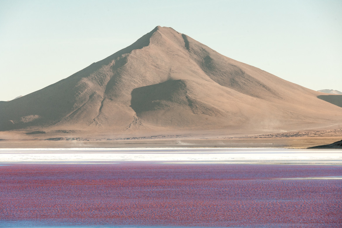
Laguna Colorada, Atacama Desert, Chile
Laguna Colorada (Red Lagoon) is a shallow salt lake in the southwest of the altiplano of Bolivia, within Eduardo Avaroa Andean Fauna National Reserve and close to the border with Chile.
The lake contains borax islands, whose white color contrasts with the reddish color of its waters, which is caused by red sediments and pigmentation of some algae.
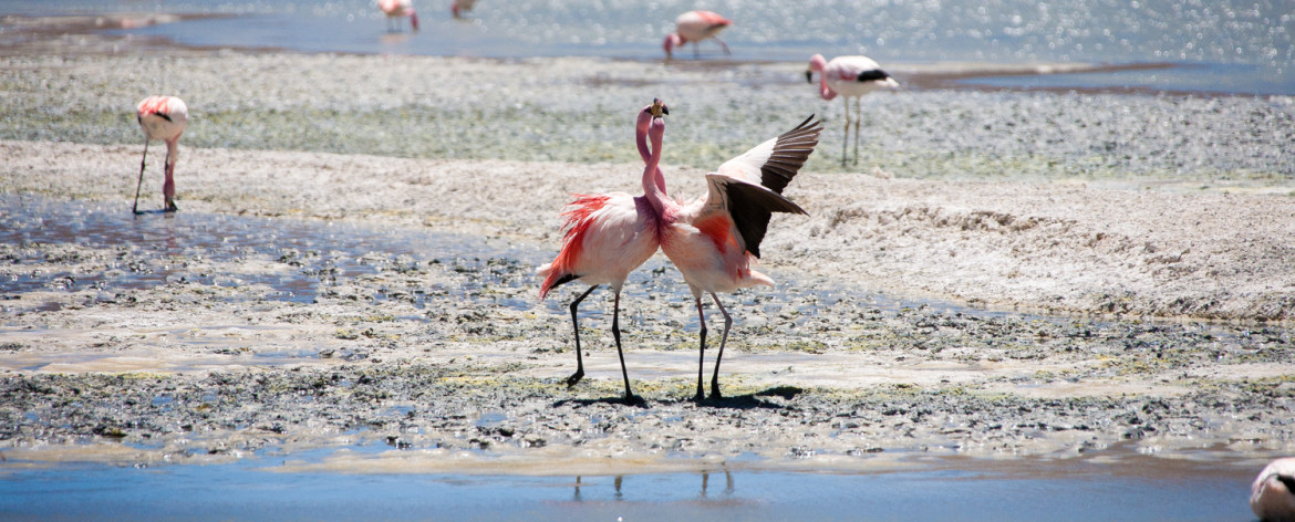
Jaymes’s flamingo, Bolivia
Jaymes's flamingo (Phoenicoparrus jamesi) is also known as the puna flamingo. Named for Harry Berkeley James, it populates the high altitudes of Andean plateaus of Peru, Chile, Bolivia and Argentina. It is closely related to the Andean flamingo, and the two make up the genus Phoenicoparrus. The Chilean flamingo, Andean flamingo and James's flamingo are all sympatric, and all live in colonies (including shared nesting areas). The James's flamingo was thought to have been extinct until a remote population was discovered in 1956
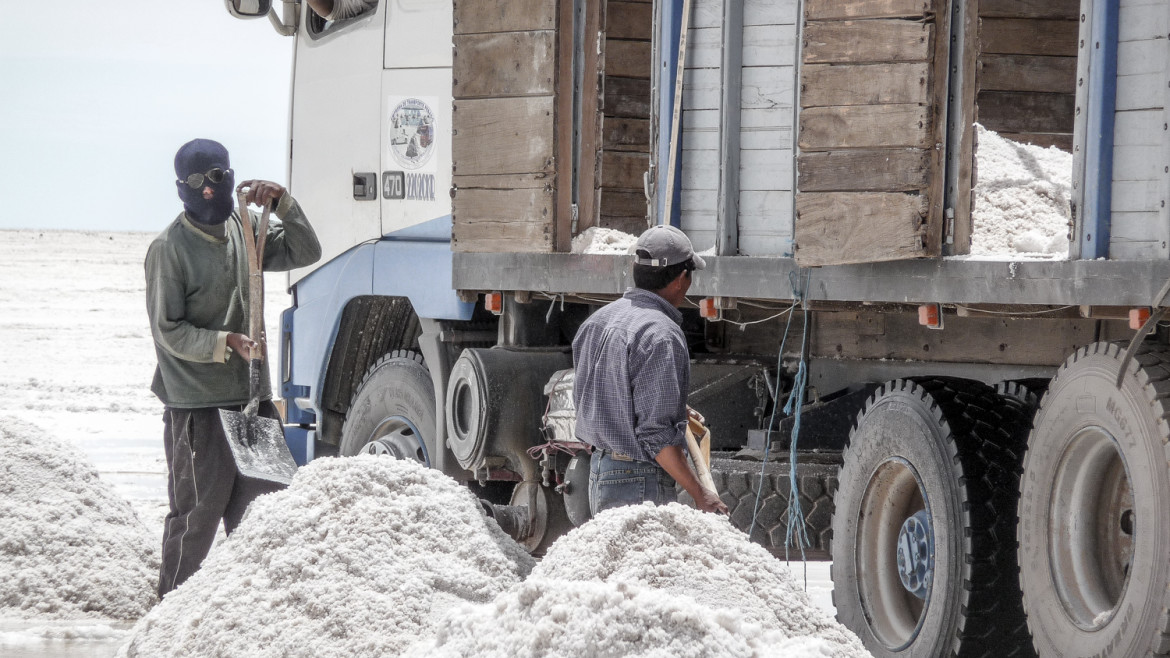
Salar De Uyuni, Bolivia
When Neil Armstrong and Buzz Aldrin became the first men to walk on the Moon, on July 20, 1969, one of the first sights they encountered from space was the Salar De Uyuni. As the Earth turned they were captivated by a vast patch of white across the lower South American continent, which they instantly took to be glacial but was in fact southern Bolivia's Salar De Uyuni, a little-known but expansive desert of cactus, rainwater lagoons and ten billion tons of salt covering nearly 5,000 square miles.
On the edge of the flats, local workers carve blocks of salt by hand for processing in nearby antiquated factories, covered head to toe in old rags to keep their bodies protected from the harsh conditions.
Salar de Uyuni, Bolivia
Salar de Uyuni (or Salar de Tunupa) is the world's largest salt flat at 10,582 square kilometers (4,086 sq mi). It is located in the Daniel Campos Province in Potosí in southwest Bolivia, near the crest of the Andes and is at an elevation of 3,656 meters (11,995 ft) above mean sea level.


Share On